This project was part of a course on using 3D GIS applications and how to use and create 3D datasets. This project was completed in ArcGIS Pro and used publicly available data collected through the NOAA.
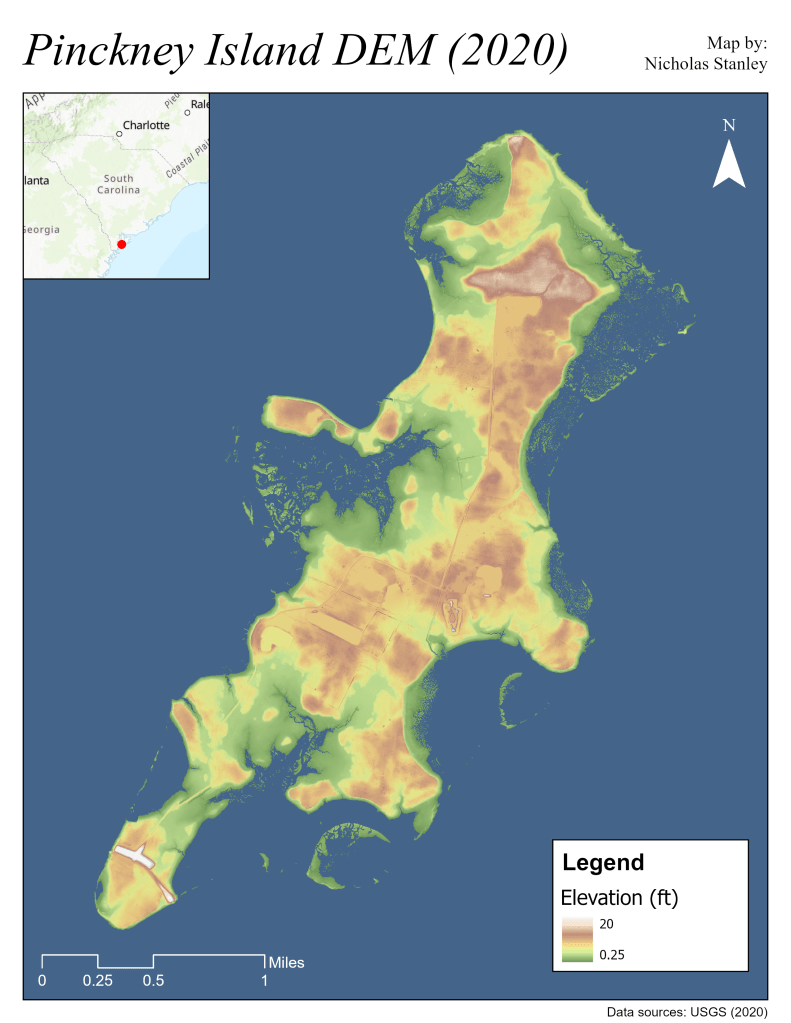
The goal of this project was to assess hurricane impacts on an island by detecting changes in elevation and shape using LiDAR data. I chose Pinckney Island from South Carolina, a designated wildlife refuge that serves as a nesting site for native species and a stopover for migratory birds. The region around Pinckney Island suffered impacts from Hurricane Matthew in 2016, leaving ecological damage for large portions of coastal areas.
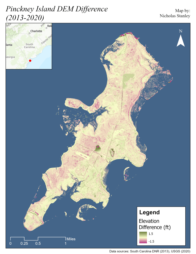
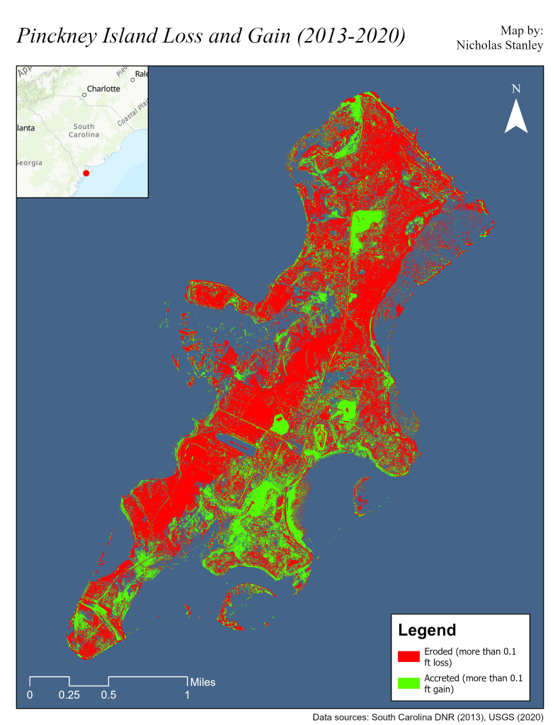
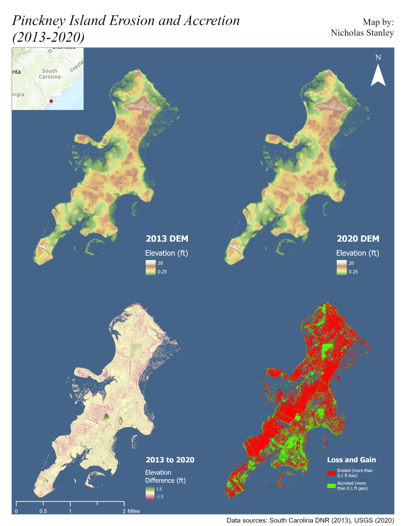
Two years of LiDAR data were collected for the analyses: 2013 and 2020. They were transformed into 5 m digital terrain maps. I calculated spatial statistics for the two DTMs and used a cell statistics tool to map where parts of the island were eroding or accreting.
While no hurricane impacts were discerned, eroded areas appear more common than accreted areas across the island, suggesting overall erosion.
Project Report
Individual Maps