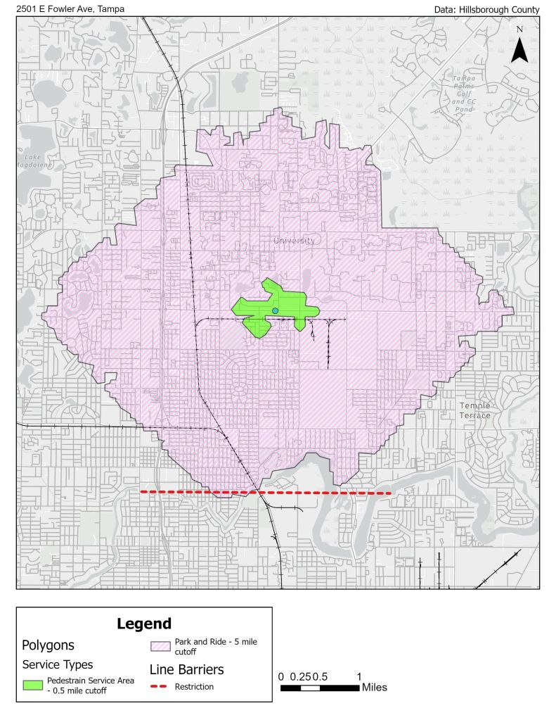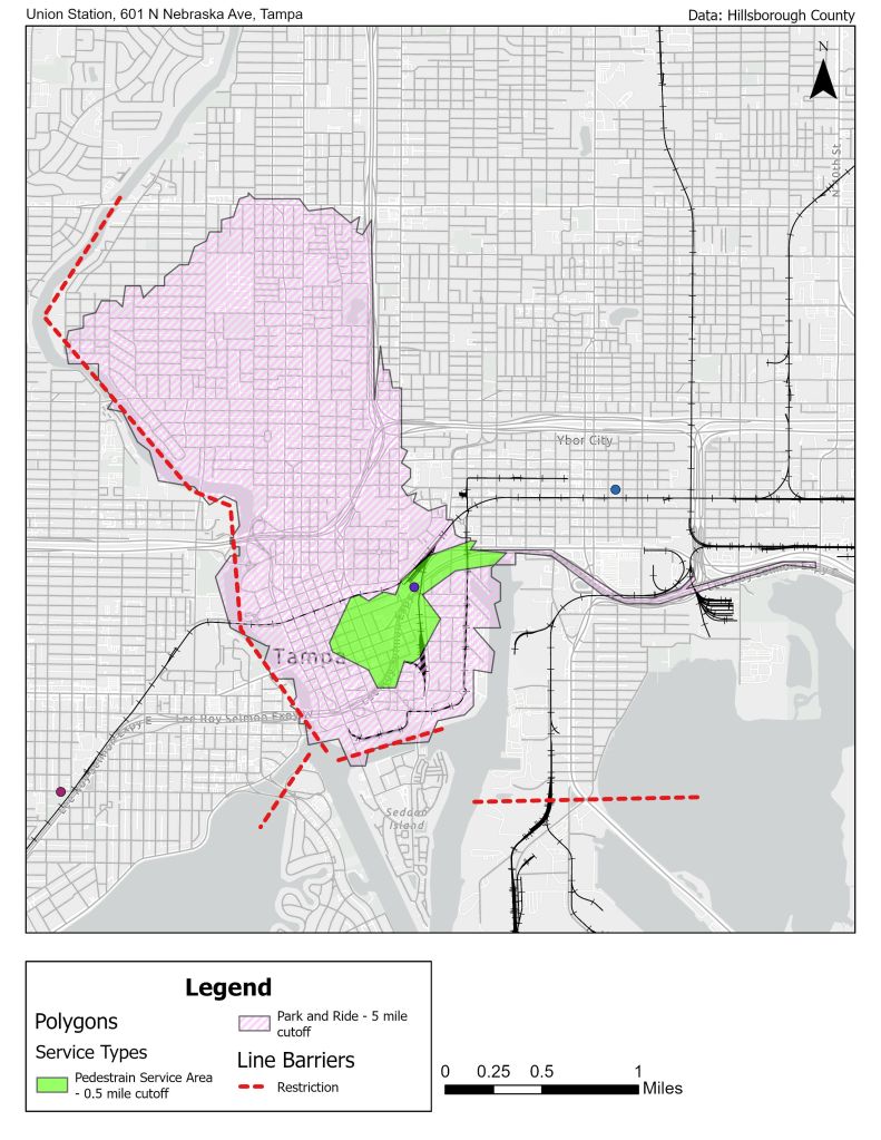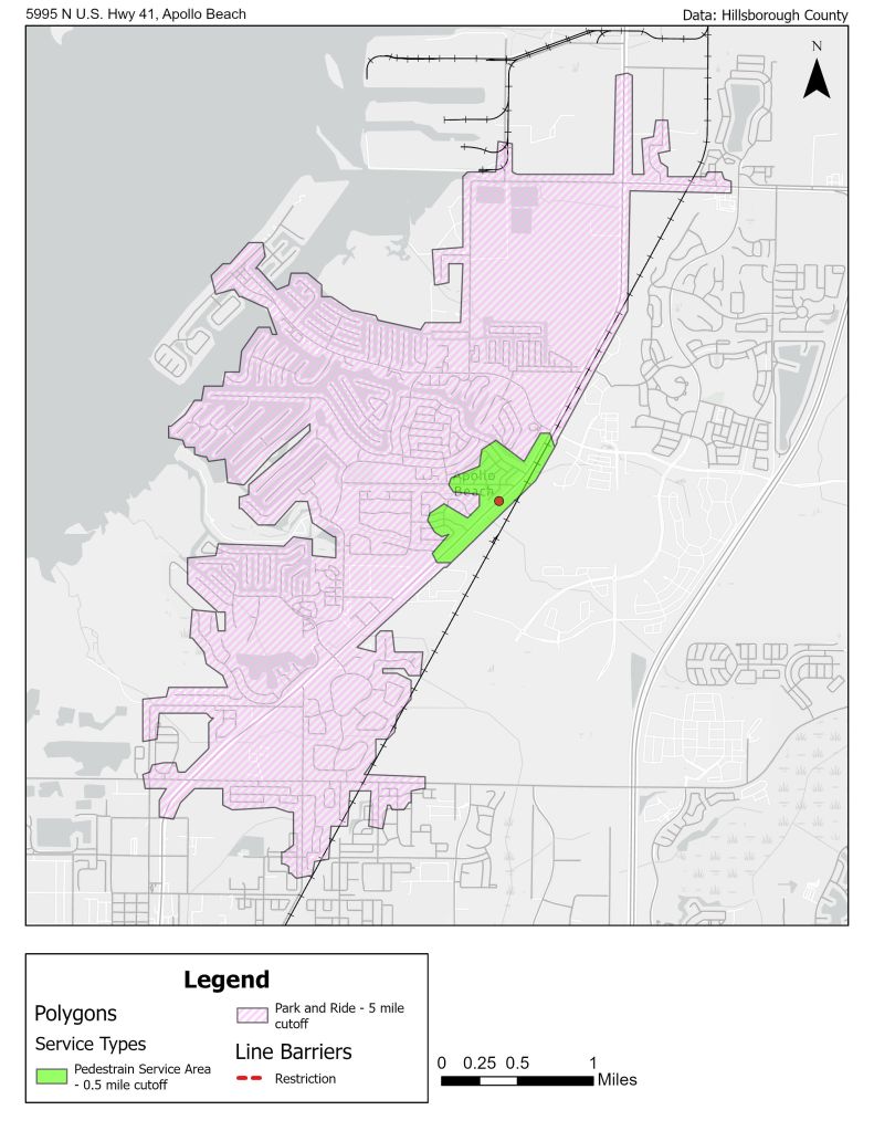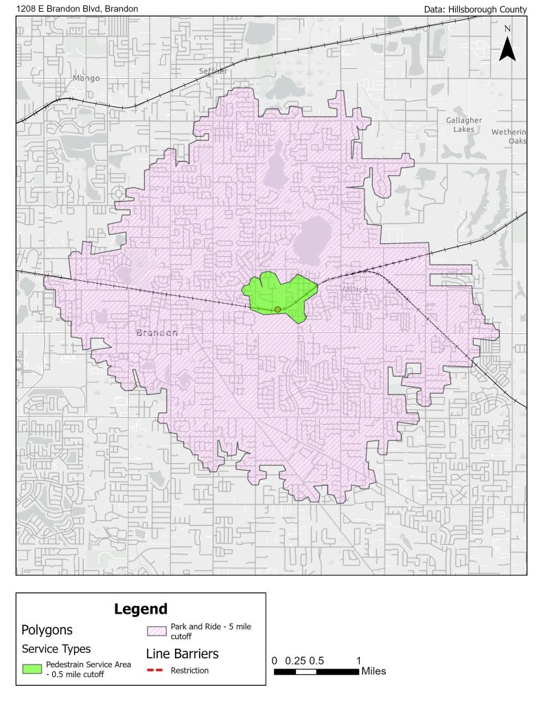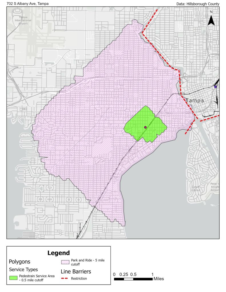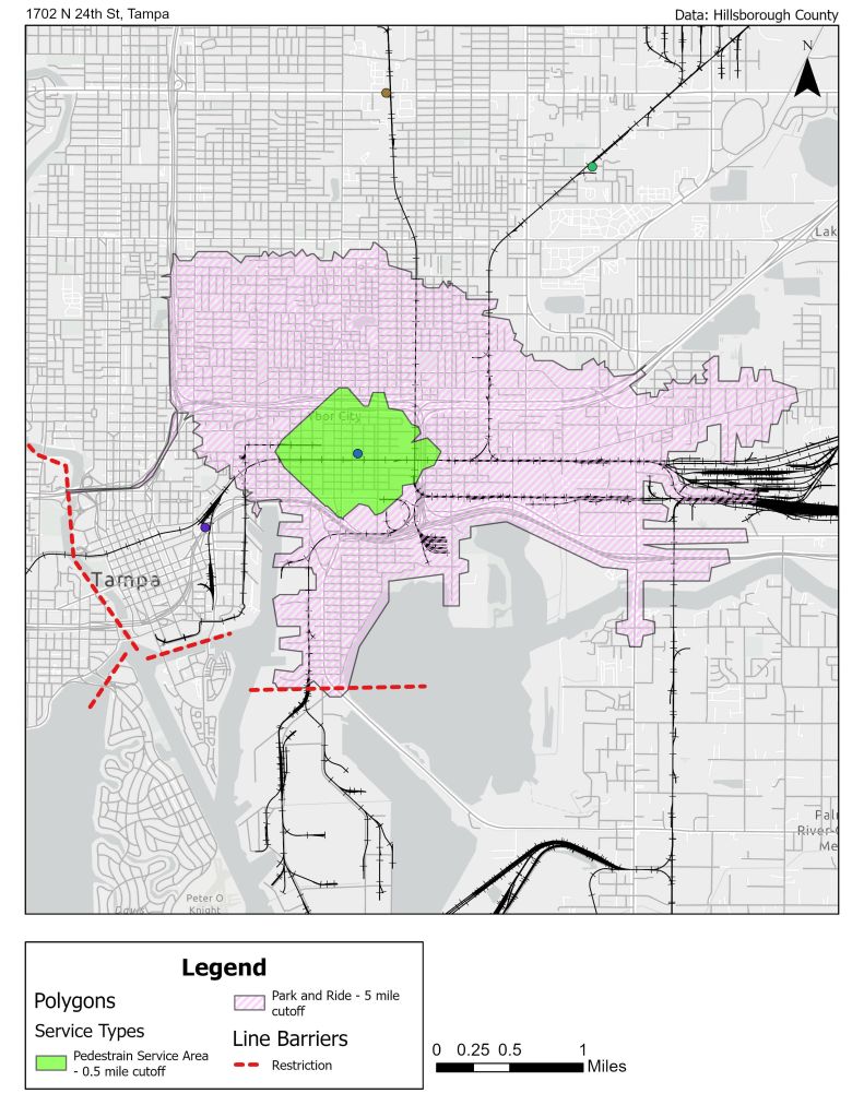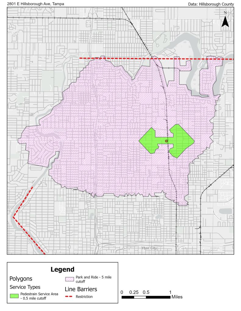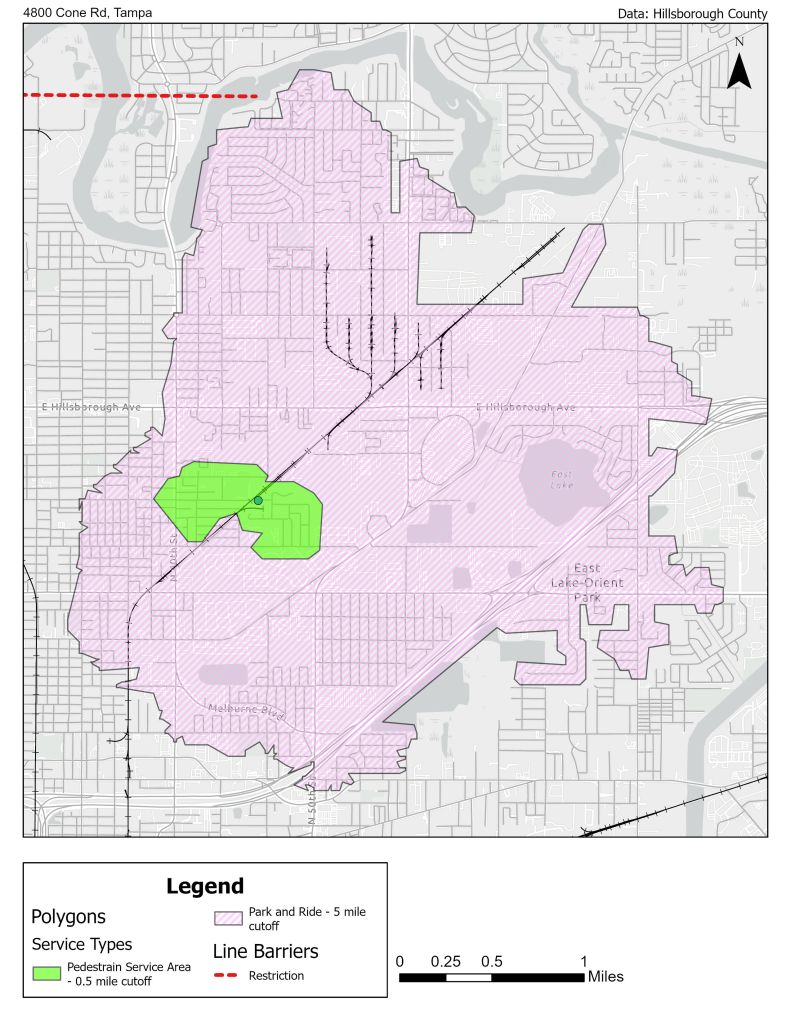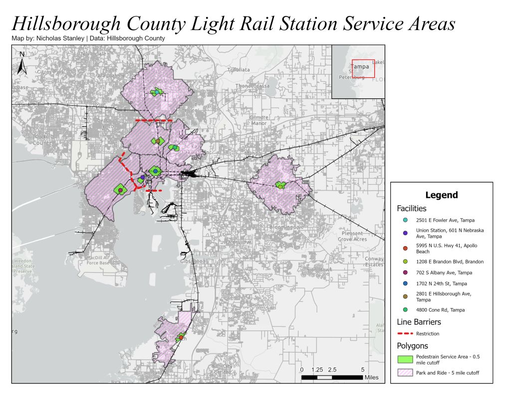
This project was part of a GIS course focused on urban analysis. It used network analysis tools in ArcGIS Pro to create service areas for proposed light rail transit stations.
As public transportation options become more important, LRT offers a potential way to reduce traffic while connecting commuter neighborhoods to urban centers. These maps propose eight stations across the counties and use service areas to organize demographic data from nearby neighborhoods.
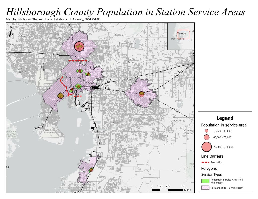
The network analysis creates service areas for pedestrian and park-and-ride commuters to access the LRT. Using future population estimates, the number of people within a respective service area was calculated per station. ArcGIS Business Analysis tools were also used to gather demographic data for those same service areas.
Individual LRT stations were exported to a map series to show local areas.
Project Report
Maps