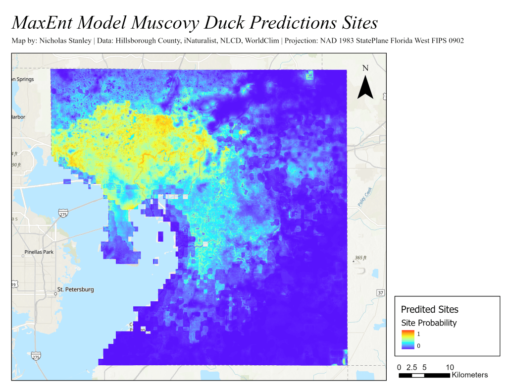
This project was part of a course on using GIS for environmental applications in wildlife research. It used the MaxEnt machine-learning model to map environmentally suitable areas for Muscovy ducks in Hillsborough County, Florida.
Using past occurrence data from public sightings, the MaxEnt model applies and weights different criteria layers to predict suitable locations for Muscovy ducks. Knowing where the ducks are located can help with their management, as they are an invasive species in this area. Based on previous literature about the ducks, criteria layers were made to reflect environmental factors that would contribute to suitable locations.
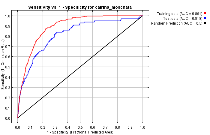
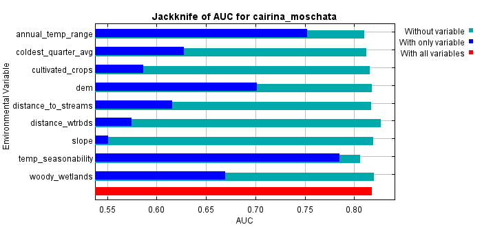
Using the MaxEnt model produced fairly accurate results with the current set of duck population data. Jackknife tests examining individual factor contributions showed that temperature seasonability, annual temperature range, and coldest quarter average played the three largest roles in determining suitability.
While some issues in data processing and the inclusion of additional environmental layers may shift results, this project shows similar findings to past literature in predicting important environmental factors. Future use of this method may benefit from fine-tuning environmental layers and duck sightings.
Project Report
AUC and Jackknife Tests